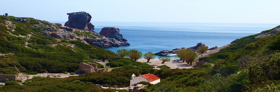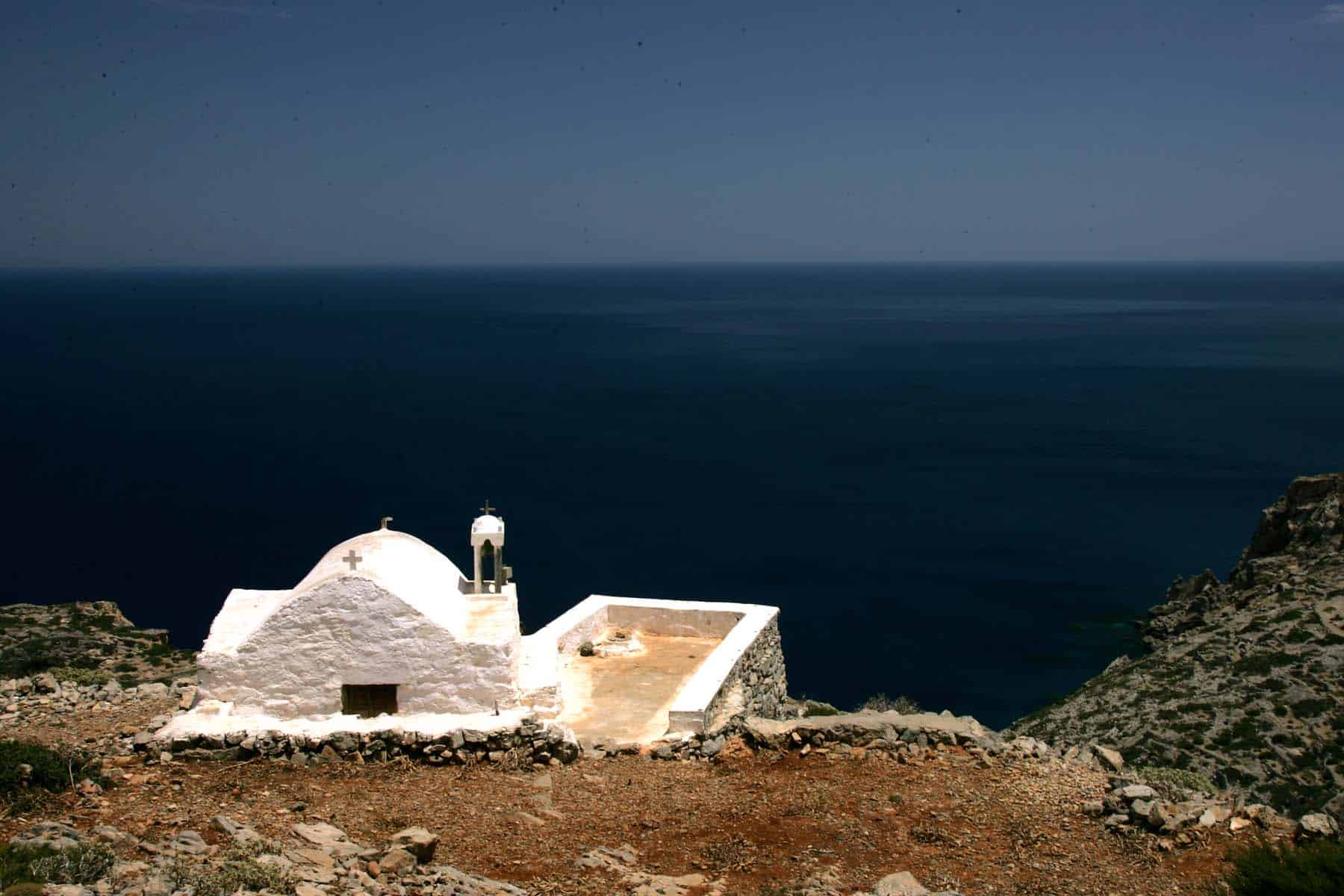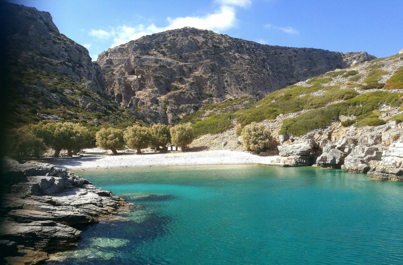
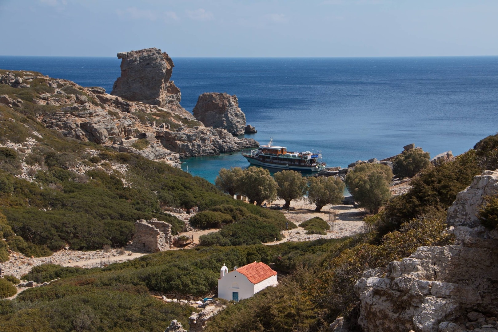
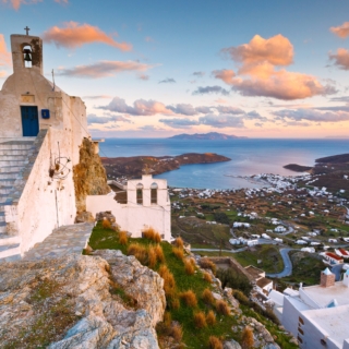
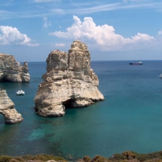
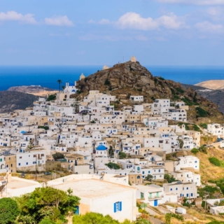
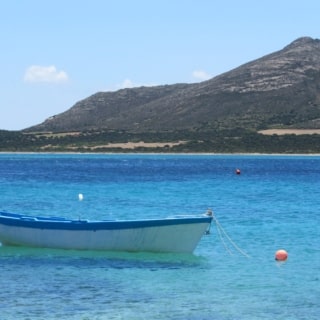
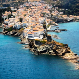
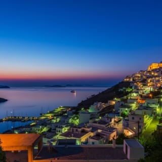
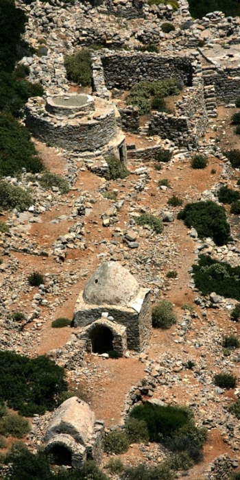
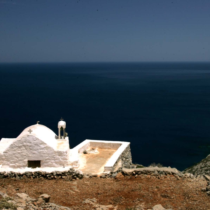
The small island of Saria offers unparallel pictures and landscapes that spark the imagination. Would you like to visit the Doric Nisyros (one of the four cities in Karpathos) or see how Saracen pirates turned the ancient palaces into small arched houses? Would you pull down the church of Agia Sofia to discover new parts of an ancient temple or pray along with the few residents in the 1960s? No need to answer. Even if you just arrived to Saria or to Alimounta (the lair of fishermen) nearby for swimming, you will still get enough of the rejuvenating energy emitted on the island.
Welcome to
Saria
View on map
Click on each island to explore it
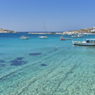
Pserimos
Visitors of Kalymnos and Kos can easily reach a hidden paradise every summer. Arriving at Pserimos you will find Avlakia, the only village on the island, which is supposed to be built on the site of an ancient settlement. Even today, remnants of ancient dwellings can be seen, and parts of pottery dating back to…
Explore
Folegandros
Until the mid 1980s Folegandros belonged to the so-called barren line. Then it was included in the regular itineraries of Piraeus and started being discovered by West Europeans and Greek holidaymakers. The island is the ideal destination for mild/ alternative forms of tourism, a fact that is closely associated with its long tradition in self-sufficiency.…
Explore
Tinos
Tinos is known all over Greece, as well as abroad, thanks to the rich pilgrimage of the Assumption of the Virgin Mary. However, this island, with its extensive and rich history in the art of marble sculpture, possesses many unique features: its villages, real masterpieces of architecture, the …otherworldly landscape of Volax with the round…
Explore

Syros
Glamorous, crowded, beautiful, is very impressive from the first moment with its two states, Ermoupoli and Ano Syros, built amphitheatrically on their hills. Vaporia with the imposing mansions which gaze at the sea, Agios Nikolaos, the renonwed Apollon theatre and the Town Hall with its square, San Tzortzis of Ano Syros, Fragosyriani of Markos Vamvakaris,…
Explore
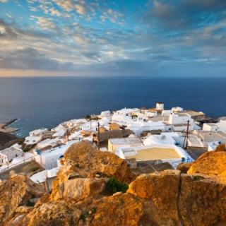
Sikinos
Authentically Aegean, exceptionally quiet, without fanfare and away from dazzling lights, Sikinos is anti-conformist and carefree. It is addressed to people who want to experience the holidays as an actual break from the workload and the hectic pace of the city. Chora, on the edge of the winds and under the roof of Pantanassa, Alopronia…
Explore
Schinoussa
This island is just a stride, where you can reach each accessible place after a few hours walk. Schinoussa addresses those who dream of peaceful vacations far away from the noise of the major tourist destinations of the Cyclades. Taste fava beans, local goat, string beans and fresh fish. Swim in Psili Ammos, Tsigouri and…
Explore
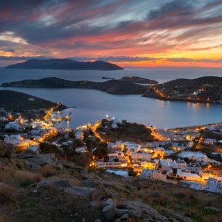
Sifnos
First and last image: Ochre and white. Kamares rest on the foot of Agios Symeon and it is reflected on the waters of Agia Marina. The next image will be given by the route towards Apollonia and the villages around it that are tied with dozens of stone walls, which are called “louria” (straps) by…
Explore
Serifos
The first view offered to the visitor of Serifos is the infertile slopes with the “petrified figures” which bring to mind the myth of Perseus. Then, the ship turns to the port and the visitor views Livadi and Chora dominating with its cube-shaped, white-washed houses hooked on the conical rock, looking just like frozen white…
Explore
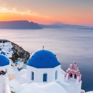
Santorini
Santorini is one of the most popular holiday destinations in Greece that has gained international recognition while being the most beautiful and romantic place to visit. What Santorini brings to every visitor’s mind is the myth of the lost city of Atlantis, the Volcanoes [Palea (“Old”) and Nea (“New”) Kammeni], the famous Caldera and the…
Explore
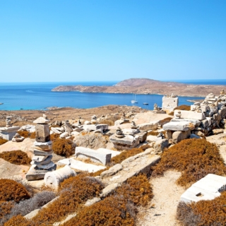
Rinia
Rineia seems to be connected to Mykonos and Delos with invisible chains for centuries. Besides, according to Thucydides, when Polycrates –the tyrant of Samos– was dominating with his fleet in the Aegean, he occupied Rineia and he dedicated it to Apollo of Delos chaining it to Delos… Those who own a private yacht will find…
Explore
Polyaigos
Polyaigos (Polivos) is an exotic paradise. The colours, the feeling it offers and the images that will stay in your memory forever cannot be easily described in words! One dip in the turquoise waters with the seabed of the bright white sand and you will feel as if you were reborn. This wondrous microcosm waits…
Explore
Paros
Call it cosmopolitan and you will be right. Call it famous in the Aegean, “birthplace” of water sports, gathering place for the young, favourite place of poet Seferis, and you will be right once again. Paros ignites people’s imagination since the pre-Historic times. Due to its abundant marble of high quality, it inspires artists. Due…
Explore

Naxos
Naxos: a small, independent world, right in the middle of Cyclades, at the heart of historical development, fertile, rich in history, abundant in ancient, Byzantine and Venetian monuments, full of customs, music and festivals organized all year long. A hospitable place welcomes you with plenty of frangrances and flavors of cheece, wine and vegetable varieties…
Explore
Milos
A woman of dazzling beauty, like the statue of Aphrodite which made the island famous all over the world: this is how Milos looks like if you circumnavigate it. White, green, pink, red, yellow colours inedibly paint the slopes and the volcanic rocks with the amazing forms and shapes. Turquoise and green-azure waters, caves, rocky…
Explore
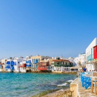
Mykonos
Since the ‘60s Mykonos has been a symbol of cosmopolitan and luxurious vacations and it is one of the most world-renowned Greek travel destinations. It is also famous for being a gay friendly destination. Hundreds of celebrities, members of the international jet set, artists, intellectuals, tycoons, ship owners and politicians have all strolled through the…
Explore
Makronisos
The dark historic memories cast their shadow on that almost uninhabited islet, only 2.5nm away from Lavrio. The memories are even harder for the thousands of Greeks, who had a relative that survived or died in the “disciplinary” hellholes. From 1912 to 1952, Makronisos operated first as a concentration camp, then as a quarantine for…
Explore
Kea-Tzia
There are destinations which attract your whole attention you right from the beginning, like a strong cocktail that burns the throat while there are those that capture you little by little, with a kind and calm manner that sooths the soul. Kea belongs to the second category. It gently calls the visitor to share its…
Explore
Koufonisia
Since the 1990s, Koufonissia have been the ultimate alternative holiday destination of Cyclades. Before that no tourists used to visit these islands, which is the main reason why their natural beauty is unaltered, with their beaches remaining unchanged, their caves unearthed and their mainland remaining virgin. Keros – the bulwark of protocycladic art – as…
Explore
Kythnos
Despite the fact that Kythnos is very close to Attica, it has managed to maintain the traits of an Aegean island. First of all, there are two small towns on the island, Chora and Dryopida, that look completely different from one another, yet both of them have simple and good-hearted people. Secondly, the island’s coastline…
Explore
Kimolos
Venetians and Francs called it ‘Arzantiera’, meaning Silvery, for the gray-white rocks that welcome you emerging from a shiny and crystal clear sea, as you reach the port of Psathi. Some wanderers believed that the name was given after the ancient silver quarries, which have not been found up to the present day. The inhabitants…
Explore
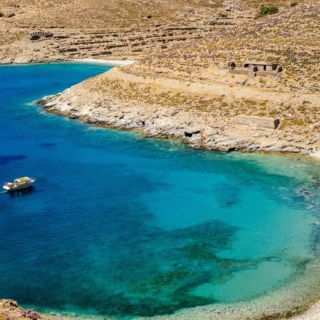
Keros
Keros is a semi-mountainous, steep island extending over a surface of 15km2 only 1,5NM northeast of Pano Koufonisi. Its highest peak is Mount Papa (at 432m). The coastline of Keros is 27km long and it is not very fragmented. Hence, there are only a few natural harbors and coves on the southern and northeastern side…
Explore
Ios
Ios is a beautiful multifold island. An island well-known in places such as Australia, Italia, Austria, America, England, France, Sweden, Germany for the nightlife which the visitors enjoy but it is also filled with traces of its long history. With golden sandy beaches and crowded or more deserted and peaceful beaches. With its Cycladic and…
Explore
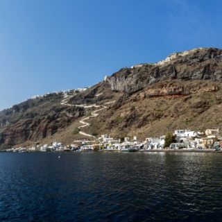
Thirasia
Thirasia belongs to Santorini volcanic complex, along with Thira, Aspronisi, Nea Kameni (volcano). Your first view over the island is on the small boats that organize trips ending at Korfo, the small port of Thirasia with the excellent fish taverns. It is only a few kilometers away from the busy villages of Kaldera, Thira, though…
Explore
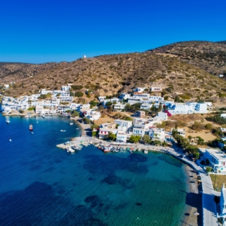
Iraklia
The pristine natural landscapes, the very few cars, the idyllic beaches where you can spend hours swimming and the peaceful and hospitable people are only some of Irakleia’s qualities. Take a walk through the alleys of Panagia, swim under the imposing rocks of Merihas, gaze upon the landscape from the top of Mountain Papas, explore…
Explore
Donousa
Windswept Donoussa stands in the northeastern extremity of the Cyclades. It is a majestic place for those who seek alternative, or just tranquil holidays away from the urban/consumer morals. Go up the alleys of Stavros. Quench your thirst with the unforgettable water in Mersini. Discover the shipwreck of World War II in Kedros. See the…
Explore
Dilos
Delos is known worldwide as one of the most important and impressive archaeological sites of Greece. The entire island is an archaeological site and has been included on the World Heritage Sites list of UNESCO since 1990. Moreover, it has been an important natural botanical museum with a wide variety of plants for thousands of…
Explore
Gyaros
Ferries traveling to Cycladic tourist destinations usually pass by Gyaros. However, this arid and treeless islet east of Kea and north of Syros is of great historical significance. It was once a place of exile, imprisonment and torture for thousands of Greek communists. Over 22,000 political prisoners were sent to this islet in the second…
Explore
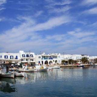
Antiparos
Antiparos is an island waiting to be discovered outside the usual routes of those who enjoy the island hopping in the Aegean. Over the last years many Greeks and foreigners have explored it and some of them have even built their villas here. Others hang around in their yachts and sailboats along its magical coasts…
Explore
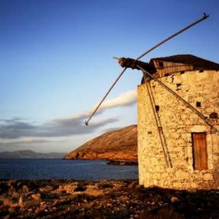
Andros
Seafaring lifestyle, natural and material wealth, abundant water resources, Andros Chora with unique architecture and history, museums that attract summer visitors, exquisite sandy beaches, magnificent villages hidden amid the lush vegetation, monasteries with long history, castles, dovecotes, windmills and watermills. The second biggest Cycladic island after Naxos extends over a surface of 374km2 and it…
Explore
Anafi
Anafi is a well hidden secret in the southernmost edges of the Cyclades, 12 n.m. from renowned Santorini. Its geographical position and its difficult, up to now, coastal access, did not allow the island to develop touristically as other islands of the Aegean did. Thus, from the moment the legendary Argonauts discovered it up until…
Explore
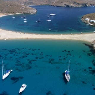
Amorgos
One of the most beautiful destinations in the Cyclades. In many areas it seems still untouched by the tourist development. The special energy that Amorgos gives out, its unique nature, the contemplation from high above, the old paths which bring out the pleasant herb odour, the lovely deep blue color of its waters, make visitors…
Explore
Halki
Imagine an island, very close to cosmopolitan Rhodes, but completely different. Imagine that you can walk the entire island in 4 hours! With castles, ancient ruins, country churches and windmills. With beaches without water sports, and roads without cars. With a Chora of incomparable aesthetics. Imagine an island destined for other biorhythms, for the coolest…
Explore
Tilos
Several castles, a ghost-village, a late-Byzantine monastery, a capital city built below the ancient acropolis, paved paths surrounded by aromatic shrubs and beaches with colors of all hues between blue and green; these are definitely but few advantages for such a small island. Tilos inspired M. Karagatsis, it was the country of the ancient poet…
Explore
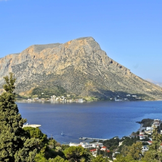
Telendos
A sea channel like this is the best inspiration for fables through the centuries. The legend speaks about the beautiful “Potha”, daughter of the king of “Telendos”, who fell in love with the prince of Kasteli right accross. Kalymnian divers talk about an entire sunken city that remains undiscovered. Telendos resembles a rock in the…
Explore
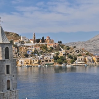
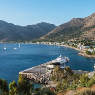
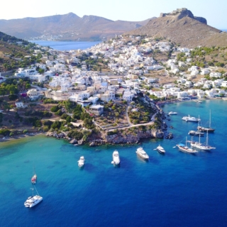
Symi
The atmosphere of this special island state charms from the very first moment: a historical preservable settlement unique in size and elegance that reminds us of the bloom it experienced in the 19th century when it had 25.000 residents. The “humanlike” mansions with their doors-mouths and windows-eyes are all located overlooking the sea, with daring…
Explore
Saria
The small island of Saria offers unparallel pictures and landscapes that spark the imagination. Would you like to visit the Doric Nisyros (one of the four cities in Karpathos) or see how Saracen pirates turned the ancient palaces into small arched houses? Would you pull down the church of Agia Sofia to discover new parts…
Explore
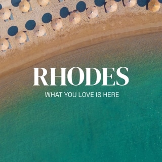
Rhodes
Rhodes, the Island of the Knights, as it is called, has much to offer to its visitors and it is hardly surprising that its economy relies to a great extent on tourism, since it is a timeless destination. The Rodini park, the ancient Kamiros and the ancient Ialyssos, the Valley of the Butterflies and the…
Explore
Patmos
The sacred island of Patmos is also known as the island of the Apocalypse and Jerusalem of the Aegean. A powerful, formidable energy runs through the alleys and gets mixed up with the fragrance of the pine trees and the warm and cold currents that caress you during your tour around the island. A tour…
Explore
Nisyros
Provided with full information about the volcano of Nisyros, the youngest of the volcanic centers of Greece, you wander dazzled by the special aura of this small island. Panagia Spiliani and the Venetian walls, Mandraki, Emporios and Nikia, the thermal springs and the impressive buildings of the baths, the black chochlaki and the «vastadia» become…
Explore
Leipsoi
On the one hand, the nature, the deep blue sea, the indented coastlines, the low altitudes – on the other hand, the humble human presence, the terraces, the olive groves, the chapels, the vineyards well-known for their wine and a whole settlement above the harbor. This is Leipsoi, a dot in the vast Southeastern Aegean,…
Explore
Leros
In the ancient Greek language, “Leros” means mild, gentle. In fact, it seems that this description about this island is still true, as it has a gentle development of tourism, smooth rocks, fertile valleys and enclosed coves. The shape of the island reminds us of an ideogram. Moreover, on this island you can find a…
Explore
Kos
The fact that Kos is among the first ranks of the most popular Greek vacation destinations is not a matter of chance. Its antiquities, its monuments from the early Christian times and its medieval castles alone are enough to place the island among the top spots of that list. But the Asclepeion, the Nerantzia Castle…
Explore
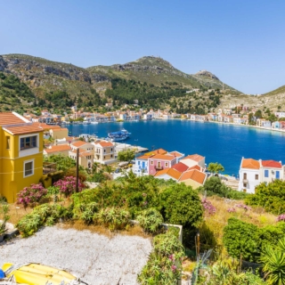
Kastellorizo
The island of only 9 sq. km is a sea junction between Europe and Asia, on the edge of the Aegean. One and only, wonderful settlement, which impresses with its colorful houses of excellent architecture and its churches, is built upon the arid rock. Similar admiration is caused by the Blue Cave, one of the…
Explore


Astypalea
What is a …Cyclades island doing in the Dodecanese? Or, better yet, what is a …Dodecanese island doing in the Cyclades? Well, one way or another, this is the physiognomy of Astypalaia. An island on the “borderline”. A cultural bridge between the two large island groups. An island located between Amorgos and Kos that never…
Explore
Agathonisi
This island is a little hidden paradise. Traditional way of life and authentic island hospitality in a landscape with minimal human intervention – that is what is offered for carefree and completely anti-conformist holidays.
Explore
More Info
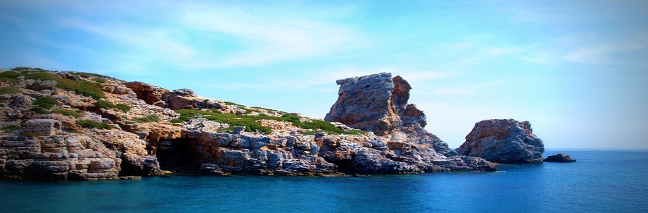
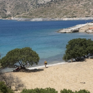
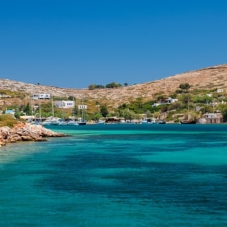
The island of Saria appears to be bound to the north side of Karpathos. In the narrow part formed between the two lands, the minimum distance is only 50m and the length of the channel is about 1.5sea mile. Saria covers an area of only 21km2 (the 13th longest island in the Dodecanese) and is characterized by steep cliffs, stone withdrawal and rocky coasts. All along the coastline there are surface and underwater caves that serve as excellent shelters for the Mediterranean seal. Onshore there are extensive shrubs, phrygana, clusters of Turkish pine forests, as well as individual areas of abandoned olive groves. The highest peak of Saria is Pachy Vouno with an altitude of 631m. The whole island has been characterized as an Important Bird Area of Greece according to Directive 79/409/ΕΕC, it constitutes a home for many rare and endemic plant and animal species and presents a great archaeological value.
Photo
Gallery